Polar Bears and Belugas

July 13, 2019

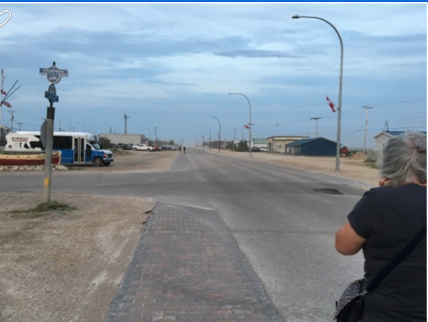
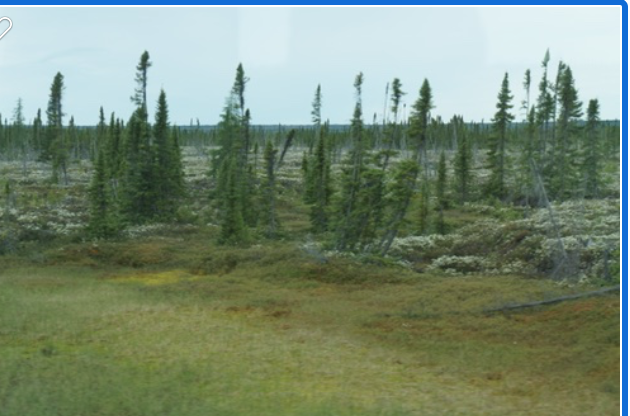
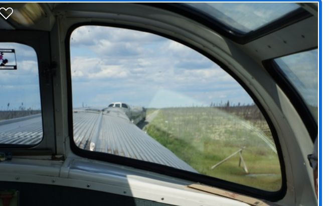
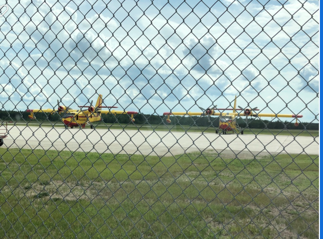
Today was going to be another exciting day.  After breakfast we went to the train station.  The train station is owned jointly with VIA rail and Parks Canada. 

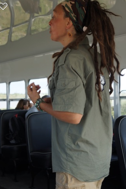
We listened to a presentation by Florence, a Parks Canada employee.  Florence is a Sayini Deni, one of the two major indigenous nations that live in Churchill.  Florence has the support of the Parks Canada to tell her people’s story.  She explained how the Deni is the original people that lived in the Churchill area.  They are known as the caribou hunters and lived on the tundra and the shores of the Hudson Bay and traded with the Hudson’s Bay Company in the late 1800. 

The other indigenous nation is the Cree who lived inland in the boreal forest and were trappers and hunters.  The two nations did not get along and often had skirmishes that resulted in deaths.  Of course they also traded with the Hudson’s Bay Company.  Over the course of several years, the Hudson’s Bay Company was able to establish some type of truce between the two nations, however the Canadian government was beginning to establish more authority on the region and decided to move the Deni nation, through treaties, inland to an area that they really were not familiar with and did not suit their culture.  They were unable to hunt the caribou and the children were sent to residential schools.  Over time, the Deni began to suffer from depression and alcoholism.  

The Deni population began to dwindle and Florence explained that they migrated back into the Churchill region.  A nation of over 300 is now down to less than 50. Florence spends a lot of time explaining the history of the Deni to the youth of Churchill and through the elders, teaches the language and hunting skills to her grandchildren.  She still traps on her grandfather’s trap line. Today both the Cree people and the Deni live in Churchill and other settlements in the area and the long time animosity has disappeared.  Florence gave a heartfelt and informative presentation and it was well received by the Red Fox group. 

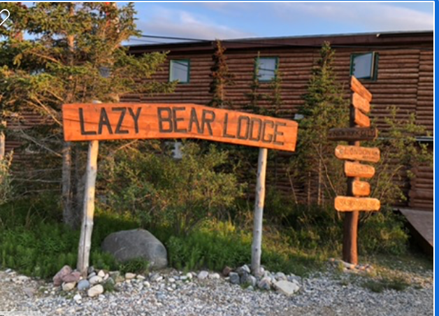
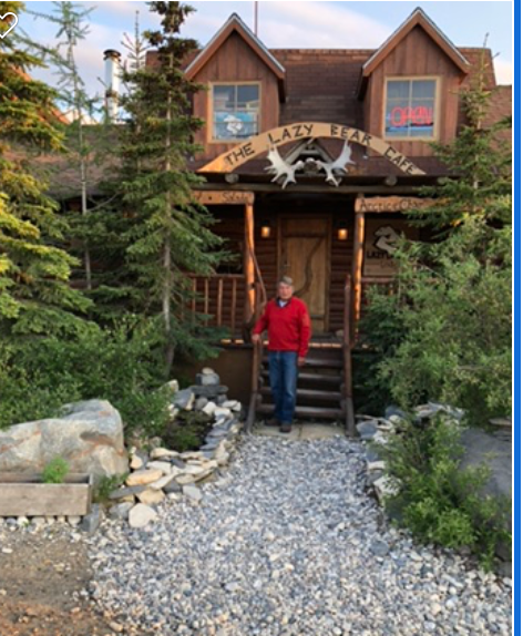
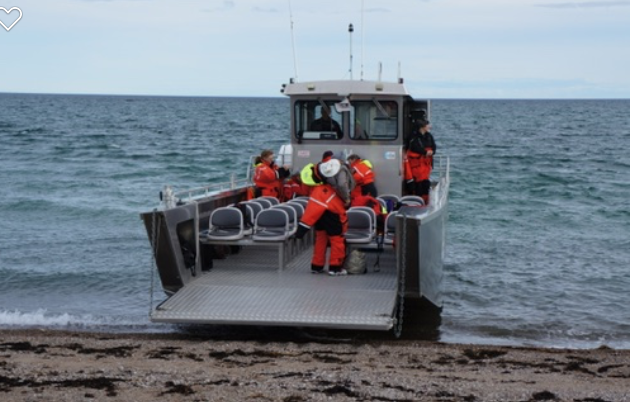
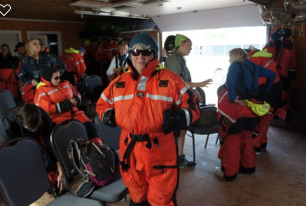
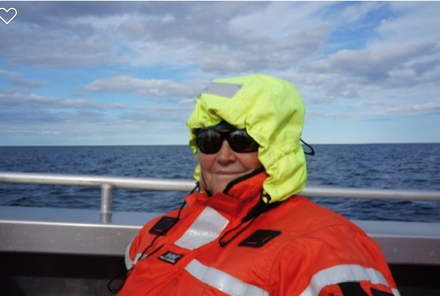
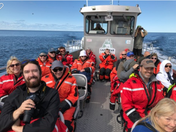
We returned to the Resort for lunch, and then boarded the bus to take us down to the docks.  We were going on a Hudson Bay Coastal Tour.  The owner of Lazy Bear Resort, Wally, owns a large flat-bottomed landing craft.  The boat is named the Sam Hearne.  It is powered by three, 300 horsepower outboard motors.  Both tour groups boarded the boat, but before we boarded we were fitted into Helly Hansen Survival suits. 

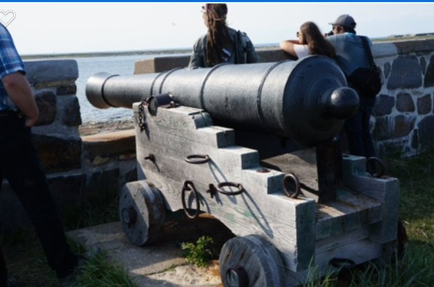
Wally gave us an introduction of the name of the boat. Sam Hearne the chief trader for the Hudson’s Bay Company in Churchill.  He was an adventurer who travelled the vast region and made the necessary connections with the indigenous people.  He was also aware that the French government was an enemy to the Hudson’s Bay Company and decided to fortify the trading fort and established Cape Merry as well as fortifying the actual trading post, which is now called Prince of Wales. 

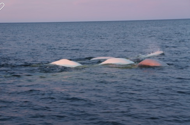
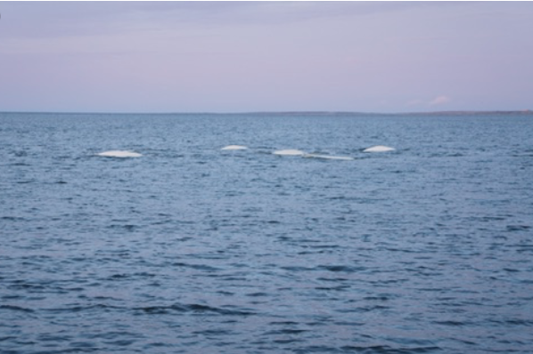
We started our journey in Sam Hearne along the coastline of the mouth of the Churchill River and Hudson Bay.  We saw many beluga whales surfacing all around us and some came directly to the boat and slowly followed it, looking up at us,   then turning upside down below the boat.  The beluga whale is the only whale that does not have its vertebrae in its upper neck area fused, so it can move its head side to side as well as up and down.  Several seals popped up periodically but we saw no other land animals. 

Wally then turned the boat north accelerated to 30 knots and we spend the next hour skimming along the water, wind blowing in our faces. We all were tucked comfortably in our survival suits and with our hoods on, were quite warm.  

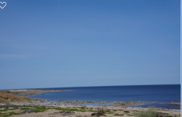
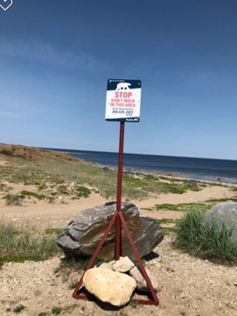
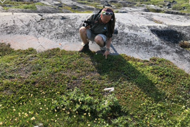
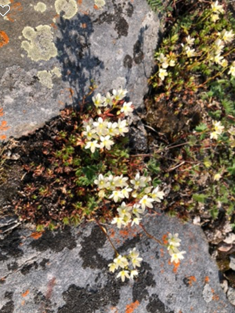
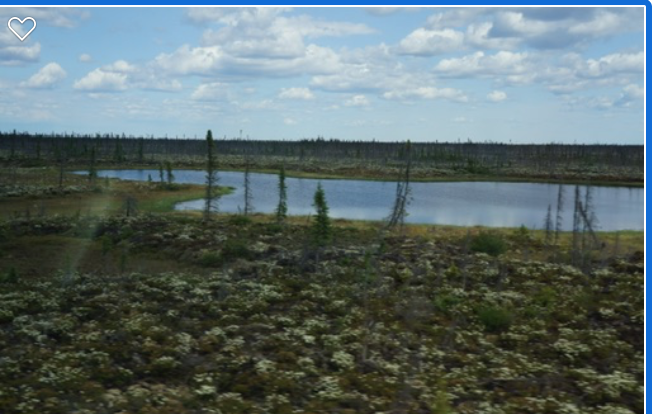
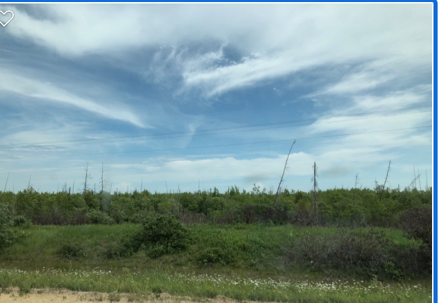
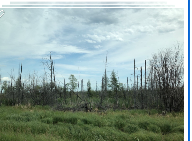
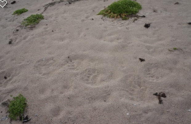
Our destination was Hubbard Point approximately 50 nautical miles north on the western shore of Hudson Bay.  As we approached slowly we all were searching the shoreline for bears. Wally beached the bow of the boat onto the shore and Judd took her binoculars and her shotgun and stepped ashore. She spent the next ten minutes walking carefully along the higher ridges scanning the area for bears.  When she felt it was safe for us to come onto land, we were warned to stay in a group and not wander off singly.  We spent about an hour walking on Hubbard Point, and Judd and Jason pointed out interesting plants and rock formations.  We found several bones and vertebrates of whales. Judd found polar bear tracks on the sandbar and we all marveled at the size of the footprint.  It was at least 8 – 10 inches across the pads.  It also increased our awareness that it could be in the area.  We then discovered an area of grass that had been flattened and a pile of scat nearby. Judd explained that the bear had probably lain down in the grass. The flattened area was at least 7 – 8 feet long, and 5 feet wide.  The scat was unusual, as it contained berries and seeds.  Polar bears seldom eat during the summer and therefore do not defecate. 

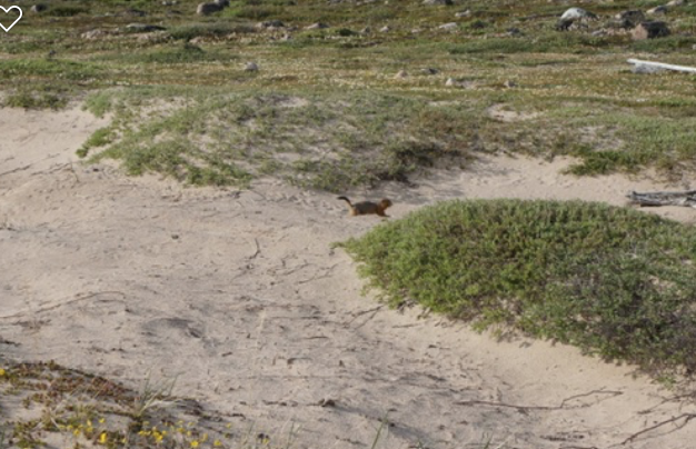
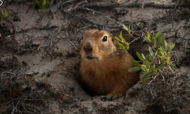
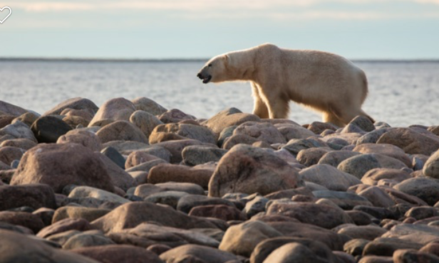
Wally remained on the boat as we wandered on the point and then announced on the loud hailer that what appeared to be a log on the small island adjacent to the point was actually a polar bear.  We all looked at the log/bear and as we looked at it, it raised its head- it was a polar bear!  Wally told us to continue exploring the point and then when we return we would go to the little island to look at the polar bear. We found small holes that were dug into the sandy banks and Judd explained that they are the entrance to the homes of the Arctic Ground Squirrel called a Seeka.  As we were looking at the holes one popped out of a hole nearby.  We all stood perfectly still and it ran towards us, stood up on its hind legs and scampered back and forth on the dunes looking at us with curiosity.  It is dark brown in color and looked like a small marmot. 

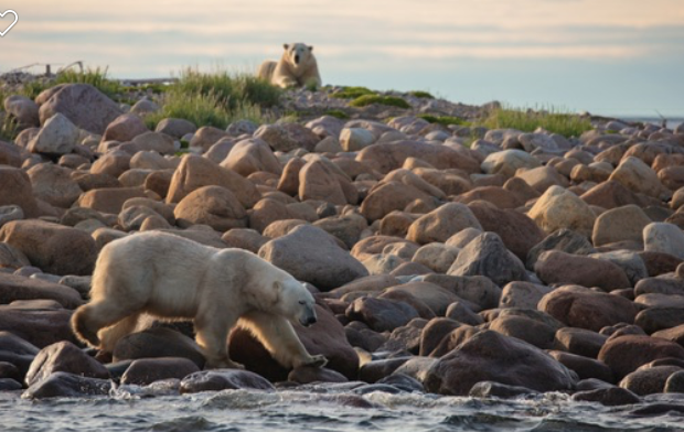
We eventually climbed back onto the boat and Wally took us to the edge of the adjacent island.  As we approached the rocky beach the bear looked up at us and suddenly there were two polar bears!  One of the bears got up and slowly made its way towards the rocky beach.  Wally backed the boat up into deeper water and kept it there.  The bear slowly came to the edge of the water and walked along the top of the rocks turning them over occasionally.  Arctic terns flew back and forth over the bear’s head and Judd explained that the bear was looking for shore bird nests and likely eating the eggs.  The other bear simply stayed on the high point of land, laying on its belly resting its chin on its fore paws watching us.  They were an off white color and Judd thought that they had not been on land long as they would have been dirtier.

We watched the bears and took photos for about a half hour and then it was time to start our journey back to Churchill.  Judd pointed out the white line of the sea ice on the horizon.  She estimated that the ice was about 15 miles away and unfortunately due to the tides we had to return or we would have gone and visited the ice shelf.

After another speeding, skimming, bumpy, one hour ride back we approached the mouth of the river, and because the tide was changing, the mouth of the river was teeming with belugas.Wally shut off the motors and we drifted towards Churchill with belugas surfacing all around us. Jason set up a pair of speakers and a hydrophone, and we could listen to the beluga squealing and singing underwater. Belugas are nicknamed “canaries of the sea” because of their underwater calls. They sound like birds chirping and tweeting.  Occasionally you can hear them making clicking sounds, which Judd explained was their use of echolocation.  The large bulb on the nose of the beluga is actually a large muscle that they can change the form of. The beluga sends out the clicking noise and uses the nose bulge to determine distance of the echo. 

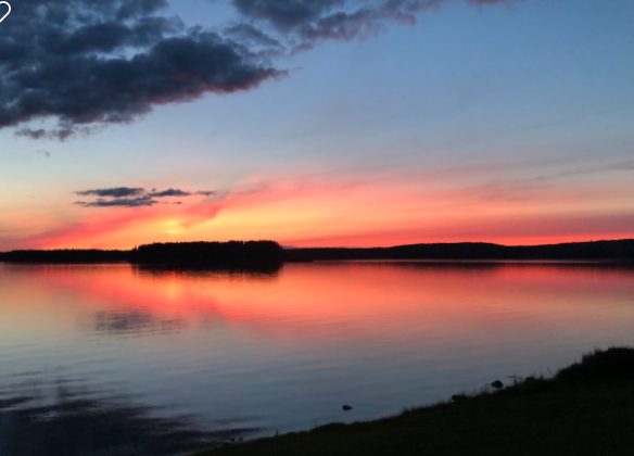
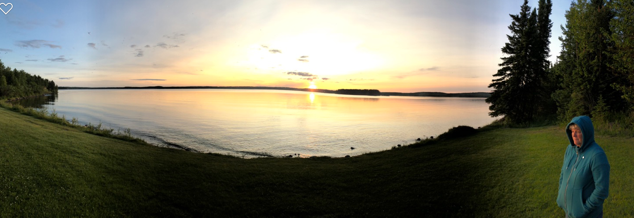
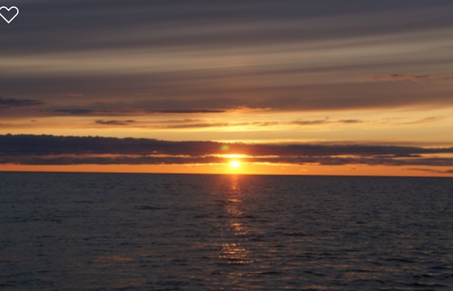
The sun was beginning to set and was providing a beautiful sunset and a backdrop to our excursion.   The resort had provided box dinners for us while on the boat so we were not hungry.  It was finally time for us to return to shore and Wally started the motors and quietly cruised back to the dock. 

After we wriggled out of the survival suits and collected our things, we climbed back on the bus.  Judging from the chatter on the bus it was evident that we all were in awe of what we had learned and saw today. Debbie and I enjoyed a warm cup of hot chocolate and then went to our room to fall into a deep sleep.  Tomorrow was going to be another adventure!                  


Judd, Bears and Belugas

July 12, 2019

Today was a good day to be oriented to Churchill.  We did not have any tours or excursions planned until the early afternoon.  We felt this would be a good time to roam through town and get to know Churchill better. It was also an opportunity for Debbie to visit the various gift shops in town. 

We enjoyed a great breakfast in the resort and then set out to explore the town.  The Lazy Bear Lodge is near the end of main street and is sort of on the edge of the town. Directly on one side is a large building that is used by Lazy Bear Resort for some of their equipment.  On the other side is the helipad for Churchill Helicopters.  It provides aerial tours of Churchill and area as well as polar bear sighting.  The conservation branch in its transportation of problem bears and general polar bear research also uses them.

We walked slowly down mainstreet, looking at the various sights and stopping at the shops as we went.  We stopped into the local RCMP detachment to visit with the members, however, the only member on duty was out on patrol.  We spoke to Kim, the civilian employee there and she explained that Churchill is relatively a calm community and the members are not overworked.  One gets that impression as we got to know more about the community. 

 One interesting feature is that main street, has an interlocking brick sidewalk beside the street on one side and the other side is dedicated for the travel of ATVs and quad’s and in the winter, snowmobiles.  The majority of the travel about town is either by vehicle or ATV. They are not driven on the street, but rather alongside the street.  Several of the other motels, hotels and lodges have small transit type buses for their tours.  We learned that there are only two licensed mechanics in the town and one is over 70 years old and not interested in fixing the computer equipped newer models.  If your vehicle breaks down you can take it to the local shop but it may take weeks or months for the new part to arrive and to be fixed.  Parts etc. are shipped by train from Winnipeg.   The locals take this in stride as part of the normal life in Churchill.

At one point we walked to the edge of town and I wanted to go to a point of high land to look out on Hudson Bay and look at the landscape. Debbie became quite adamant that we should not go any further and we had a bit of a discussion about that.  I was to learn later that she was absolutely right, as there are warnings for folks not to go to certain areas alone without an armed bear sentry. I apologized for that idea….

We walked to the community beach and looked out over the Bay. You could see the white bodies of the beluga surfacing all over the bay.  It was simply a constant sighting of white whales.  Hudson Bay has a population of approximately 60 to 80 thousand whales and their favorite summer place is the area around Churchill and the Churchill River estuary.  Belugas are a northern whale and they migrate to Churchill to have their babies and rear their young before migrating back north in the winter. We learned that the ice came off of the river in the last week of June.  Canada Day in Churchill is celebrated with a “polar bear” swim and the folks go for their first swim in the bay!

We stopped in to the Eskimo Museum.  The Museum is dedicated to the Inuit life and culture. It features many indigenous carvings and the many interesting tools, clothing and hunting weapons of the Inuit. The curator gave a very informative presentation about the various aspects in the museum.  

It was time for lunch and we walked back to the resort. The resort divides the guests into groups and gives them a northern animal name.  Our group was called Red Fox.  Our tour this afternoon was a cultural and heritage tour.  We met in the lobby and there was approximately eleven in our group.  We were to be driven to the various places on a converted school bus.  

Our guide dedicated to our group was an energetic lady by the name of Judd.  She burst into the lobby and announced herself by saying, “Hello Red Fox, I’m Judd, your guide for the week!”  Judd is 40ish, with long brunette dreadlocks with a small conch shell entwined in them, dangling earrings, beaded bracelets, wearing capris, a long sleeve shirt rolled up ¾ length and wearing open work boots without laces.

Judd has lived in Churchill for eight years.  She is a qualified guide, and after her first impression on me drifted away, Judd became an absolute joy to have as a guide.  Her interest in life, culture, animals and plants of Churchill was infectious.  Besides being a guide for Lazy Bear Resort, Judd has several other jobs that keep her employed and she is basically a fixture in Churchill.  Before coming to Churchill Judd lived in Vancouver, guided in fishing camps on the west coast and worked on fish boats.  Her parents live in Nanoose, B.C.

Our tour consisted of a slow drive through the Port of Churchill, where Judd explained the development of the port back in the 1930s to today.  We drove past some of the left over relics of the residences of the workers and builders of the port.  She explained that although these relics look “untidy” the fact is that it costs too much to clean up or remove so they are left to disintegrate naturally.   

We visited the site of Cape Merry.  Before we exited the bus, Judd explained that everywhere we go this week she would be carrying a shotgun.  It is loaded with flares and “bear bangers”. She explained that polar bears are very hard to see on the tundra.  Even though they are large, they are not generally white.  She would go out first and scope the area before calling us out of the bus.  She did this at every site we visited.  

Cape Merry is at the mouth of the Churchill River.  It had been built by the Hudson’s Bay Company to protect the actual fort that was situated across the river.  There were several cannons placed in the thick rock walls of the cannon battery.  Judd explained that the battery was actually built by employees of the Hudson’s Bay Company and as a result was not really an effective security as the employees were not soldiers, and did not think like soldiers.  The result was that one of the cannons was actually placed pointing at the Trading Fort across the river!   The site overlooks the Bay and you could see the belugas swimming.   Judd stopped many times on our hike to show us the many tiny flowers and plants that grew out of the rocks and lichens.  The growing season for these plants is about six weeks. She explained how some were used for medicinal purposes and which ones were edible.  (Judd did mention that before she arrived in Churchill she was a vegetarian, however she quickly had to change her diet for lack of vegetables.) She was so informative and interesting.

At one point she stopped the bus to point out an Arctic Hare.  It was sitting on a rock and looked at us for quite a while before scurrying off.  Judd told us that these hares change to a pure white color in winter. When you approach them they stay completely still because they think you don’t see them.  In the summer they turn a grey color and they still think they are camouflaged and you can almost walk up to them.  Later, she suddenly stopped the bus when she saw a Ptarmigan sitting in the bushes.  As we watched, Judd became very excited because the Ptarmigan had four chicks with her. She said that she had never seen Ptarmigan chicks before.  

We then visited the site of a plane crash.  The wreck is affectionately referred to as “Miss Piggy” as the nose cone is missing.  She explained that the plane was a transport plane that was fully loaded and had just left the Churchill airport when it experienced mechanical difficulty and the pilots where successful in belly flopping the plane onto the rocks.  No one was injured and most of the cargo was salvaged.  A mural has since been painted on the side of the plane and it has now become an attraction that tourists can clamber onto.

We then visited the Polar Bear Holding Facility, commonly known as the Polar Bear Jail.  The building is a converted airplane hangar.  It contains 25 holding pens inside.  Judd told us that when polar bears come into town, conservation officers chase them out. There are also four employees of the town who are full time polar bear sentries.  When a bear is spotted, alarms are set off and the team goes into action. The bear is tranquilized and transported to the “jail”.  They are keep in custody for about 30 days or more and then transported many miles north and placed back on the ice floes.  With the receding ice, bears are commonly found in Churchill, (200 last year!).  They are usually not white but a brown color because they lay in the mud and dirt. They do not eat, as they live solely off of their accumulated winter fat.  Although they are dangerous when confronted they are basically very lazy, and just want to “veg out” and wait for the return of the ice. All attempts are made not to destroy the bear.  Canada has 2/3 of the total world polar bear population. 

Judd pointed out the different murals on the buildings throughout Churchill.  In 2017, eighteen mural artists came to Churchill to paint these murals.  It was called “Seawalls Churchill”.  On one building the words “Know I’m Here” is painted on the side.   It refers to the documentary about the project, called, “Know I’m Here, Reason to Smile”, produced by CBC.

We returned to the resort for the evening.  We walked to the Tundra Inn, about three blocks away, to meet up with Traci and Max, and had dinner with them. We also met Ron and Chris from Ontario who were on the same tour as them. We compared our day’s events. They had one more day with their hotel and would be leaving by train the next day.  We said farewell to them all and walked back to the resort.  It had been a very interesting day.

Churchill at last!

July 11, 2019

Debbie slept like a log, I could hear her snoring, but I had a fitful sleep.  The train stopped many times throughout the night, to disembark passengers to the various settlements.  Because we are travelling through the boreal forests, the rail bed is built on the muskeg and is very soft.  As the train travels along it rocks side to side and travels very slowly. 

We are used to small spaces now so having a shower in the sleeper car was no problem and quite enjoyable.  It was time for breakfast and we were welcomed in the dining car by the host and we sat with Mike.  We learned that Mike is a professor of mathematics and has travelled to many interesting places. I did poorly in mathematics so that part of the conversation did not last long.  He is attending a conference in Winnipeg and decided to make a “side trip” to Churchill. He had booked the Churchill Hotel and planned his excursions for his time in Churchill.  

Leroy also joined us.  Leroy lives in Churchill and is travelling back with his family after spending time in Winnipeg.  Leroy owns and operates the propane company in Churchill, and is also the fire chief. We had lots of questions for Leroy as he explained the winter of 2015 that almost wiped out the community and caused all the floods in the spring.  These floods wiped out the railroad, the main source of supplies for Churchill.  After three years of political wrangling the railroad was finally rebuilt, so the community suffered for three years in getting food and necessary supplies. Leroy told us that that winter the community almost ran out of propane.  All of the homes and buildings are heated with propane.  He explained how he managed to bring in 150 large propane cylinders by rail just in time. The community worked together to assist the elderly and disabled to make sure that they were looked after during temperatures that dropped down to -55 degrees for a long period.  They also experienced above average snowfall that further caused more danger.  It is clear that Leroy loves his community and that there is a strong sense of community in Churchill.

We then went back to the dome car to watch the wilds of Manitoba pass by.  The boreal forest stretches out as far as the eye can see. The trees are stunted in growth.  Mainly white and black spruce with tamarack and pine and the occasional aspen interspersed.  The ground cover consists of white hillocks of caribou lichens and low growing bushes. Throughout the forest floor are small ponds called melt ponds.  These ponds fill with water from the melting snow and slowly evaporate through the short summer months.  Many small lakes dot the landscape and are homes for the waterfowl and wildlife.  They are also the breeding grounds for mosquitoes. We were looking for moose and caribou but did not see any wildlife.  It truly is an unforgiving environment. 

The dome car soon was the home for all of the Churchill travellers.  We sat in small groups telling stories of our lives, watching the landscape, commenting on what we see, and anticipating what we would find in Churchill.  

We met David and Susan from Toronto.  When they found out that we were booked for the supply ship from Sept Isles in September they told us they had taken that trip last year!  They told us what we can expect and that they had thoroughly enjoyed it.  They also encouraged us to spend at least four weeks in Newfoundland and that Newfoundland is their favorite province.  

When it was time for lunch we left the dome car and met again in the dining car.  This time we sat with Emmet and Karen.  Again the unexpected happened.  Emmet and Karen live in Brandon and they also own a cottage in Riding Mountain National Park and they also know John and Tammy and know of our friends Bill and Carol! It always amazes me how people can connect to each other.  Karen was suffering from motion sickness and could only come up to the dome car occasionally. Throughout the afternoon people would come and go and we would ask each other where we were. Traci had a Manitoba map and would announce the little stops that we came to. Later in the evening we found out that we could buy liquor in the club car so some of us went down and paid the $9.00 for a bottle of beer.  Supper was served and we sat with Max and Traci.  Throughout the day, the meals and snacks were delicious. 

About an hour out of Churchill the landscape changed drastically. Suddenly the boreal forest ended and the tundra began.  The landscape was rocky with very few trees. The trees that were there were spindly and had no branches on the north side.  We later found out that although the trees were less than 12 feet high they were well over 300 years old.  Also in the dips were more melt ponds surrounded by lichen and ground cover that had tiny flowers and berries.   

We could see Hudson Bay in the distance.  We could see the tall grain elevators standing above the low homes and buildings.  The train had to shunt around on the tracks and eventually backed up to the train station. We were supposed to arrive in Churchill at 5:00 pm, however we finally arrived at 9:30pm.  The trip turned out to be a twenty-hour trip!

When we arrived at the terminal, a man approached us and said, “You must be Bill and Debbie.  I’m Jason your guide from Lazy Bear Resort”.  He took our bags that we were carrying.  In the lobby of the terminal is a stuffed polar bear standing on its hind legs to greet the passengers.  We had to take a photo of that.  Lazy Bear Resort is approximately one kilometer from the train station on the main street of Churchill.  Jason gave us a short tour of the town showing where the post office, banks, liquor store are and then brought us to the resort.  The resort is a long two-story log building.  Inside the restaurant the tables and chairs are made of wood and a stone fireplace is in the centre of the room.   Our room was on the second floor, with two queen size beds and all the furniture of a modern hotel room.  The bathroom is modern and spacious.  After we had checked in and Erin the receptionist oriented us, it was time to go to bed and rest as we were both tired but excited to see what tomorrow would bring.

Thompson and the Train Ride!

July10, 2019

It is sort of strange sleeping in someone’s house when they aren’t there.  It is kind of like a Goldilocks thing.   Sorab and Victoria certainly made us feel at home, (even if they weren’t there), by leaving food in the fridge for us to eat, laying out toiletries for us to use and leaving some cold beer and wine in the fridge!  We enjoyed a nice shower and breakfast in their home and then decided that we needed to prepare and pack for our trip to Churchill.  Debbie had contacted the VIA rail and confirmed our reservations.  We shopped at the various stores to pick up some things to take to Churchill with us. We were not expected to board the train until 5:00 in the afternoon, so we drove around Thompson and checked out some local sights.

Thompson is basically the end of the line on Highway #6,  and has a population of approximately 14,500 people.  Its economy is mainly supported by the nickel mines and has a large provincial and federal government worker base.  Thompson in the 1800s was also the terminus for many of the trappers and traders for the Hudson’s Bay Company and the large groups of aboriginal hunters who travelled on the Nelson and the Burnwood river systems.  

We spent some time taking photos of various interesting sights. On the end wall of a five-story apartment building is a beautiful mural of a wolf.  The mural is a reproduction of a 1990 painting by Robert Bateman. Winnipeg muralist Charles Johnston reproduced it.  Throughout the town, there are statues of wolves painted in various colors and donated by community groups or organizations.  The town of Thompson is branding these wolf statues to highlight points of interest of historical, cultural, geographical, and other significant perspectives of Thompson.  

In the early 1900s the railway (owned then by the Hudson Bay Railway) passed through Thompson to Churchill and was the main source of travel to the various settlements north to Churchill.  Later in the mid 1900s large hydro-electric dams were built on the Nelson river, and subsequently the town of Gillam was built to support the employees of Manitoba Hydro.  Highway 280, a secondary road, ends at Gillam.  From there is are no roads going north.

At about 1:00 we received a text from VIA rail telling us that the train is not arriving until 8:00 pm. We had now packed two carry on bags with our necessary clothes etc. for Churchill and were anxious to get going.  We went to the Boston Pizza to have supper and watch the football game. While there, we received another text telling us that the train was further delayed and we could not board it until after mid night.  We returned to Sorab and Victoria’s home, watched television until 11:30 and then phoned for a taxi.  When we arrived at the station, many of the folks who were travelling to the settlements had boarded.  We were allowed on and checked into our sleeper cabin.  

We were too excited to go to sleep right away so we walked to the observation dome car.   We met several fellow Churchill bound travelers.  Tracie and Max were from a small town in Saskatchewan, Jack and Rita from Victoria, B.C and Mike, who is from New Mexico.  Most of them had travelled by VIA from Winnipeg and were as anxious as we were to get going. They have been experiencing the delays since Winnipeg. We were going to have lots of time to tell stories, but after getting to know each other, the train began to roll and we all felt it best to go to bed.  Debbie chose the upper bunk.  I laid in the lower bunk and looked out the window.  I was soon to learn that the train was only going to travel at about 15 – 20 miles per hour and I would have lots of time to watch the boreal forest slip by.  Even at 1:00 in the morning there was still enough light outside to see things and it took me a long time to fall asleep. 

To Thompson Manitoba!

July 9, 2019

Thompson, Manitoba is a 4 hour drive from Clear Water Lake, so we needed to head out right after breakfast.  We left the campsite by 10:30 and headed north on Hwy#10, and then east on Hwy#39/6.  We made a short diversion into Cranberry Portage to top up our fuel.  Cranberry Portage is a tiny hamlet just north of the Hwy#10/39 junction.  Gas price was 1.29 the highest we have paid since leaving BC.  Availability of fuel is hit and miss from here to Thompson. 

Hwy #39 is a long straight road heading northeast through boreal forests and between many lakes, large and small.  The highway passes through Grass Lake Provincial Park and several other Provincial parks. The road is all paved but is suffering from frost heaves and has many serious rough sections.  During one “pit stop”, Debbie had to reposition a lot of things in the trailer that have shaken out of their places. You could count the number of cars we met for the four hours on two hands.

My navigator, Debbie has an uncanny ability to see animals along the side of the highway. Today she spotted our first sandhill cranes. Sandhill cranes are abundant in Manitoba, and we tried to take some photos of these birds however, they are quite elusive. We will try to get a good photo later on. As far as other animals go, we have not seen a single deer, moose or other creature other than horseflies!!

Boreal forest and desolate endless highway

We arrived in Thompson at 4:30.  Thompson is our departure point to board Via Rail to Churchill, Manitoba.  We have reserved a 4-day stay at the Lazy Bear Lodge to kayak with the beluga whales and take excursions to see the polar bears!

Our friends and past colleague, Sorab and Victoria have offered to house our rig at their home and let us stay at their home until we board tomorrow.  Unfortunately, they are going to be in Winnipeg so we won’t see them until we return from Churchill.

We reflected where we have been since we got to Manitoba and drew out our route so far. We certainly have wandered around the provinces!!

All who wander are not lost!!!

We pulled into their yard and settled in for the night. We are excited for tomorrow, as we have looked forward to this part of the trip.  I set up the computer to update the blog posts because there will not be any further blogs until after July 17th.      


The Pas and Clear Water Lake

July 8, 2019

We were going to go kayaking today, but the weather was not cooperating.  We needed to go back to The Pas, 18 kms south, to refill a propane tank that ran out last night.  We had a second tank but due to our location we felt it was prudent to make sure that we had enough propane all the time.  We also needed to make some more phone calls so we needed some cell phone coverage.

We did our errands and phone calls and then explored the small town of The Pas.  The main industry in The Pas is the Kraft Paper mill and it is also home to Hudson Bay Railway and the Manitoba Forest Fire Tanker Base.  

Along the banks of Clear Water Lake there are several small subdivisions of cottages lining the shores.

Earlier this week we had noticed that the population of horseflies had really increased.  When we stopped the vehicle, horseflies literally come from all directions, flying against the sides of the truck and trailer.  They hover around the windows and wheels.  We spoke to the locals who informed us that they like the heat from the truck and its exhaust, brakes etc.  If you walk away for the truck they stay with it until things cool down. When I looked at the grille and the front of the trailer it is obvious that we didn’t make much of a dent to the horsefly population even though many of them lost their lives on the front of the truck. 

The evening was spent in front of a campfire, inside the net tent.  Although we wanted to experience more of the lake, we couldn’t kayak due to weather and we are leaving for Thompson tomorrow.

The Pas and Clear Water Lake

July 7, 2019

Time to pack up again, and we needed a shower before be leave.  We both had that “smokey” smell and it was a welcome opportunity to use our shower again and enjoy it out in “nature”.  After the shower, breakfast and then break down camp. It went so smoothly that we were ready to roll within the hour!  Our next door neighbor, Dalton, came over to see our rig before we left.  He had been watching us the past two days and finally came over.  During our stay we had three separate sets of folks drop in to check out the Armadillo. I suggested that we charge admission but Debbie quashed that idea.

Today’s leg of our journey was taking us to Clear Water Lake Campground just north of The Pas, Manitoba.  We had made reservations for two nights.  

Clear Water Lake is reportedly one of the most clearest lakes in Manitoba.  You can see to a depth of 30 feet because of the clear water.   The lake has a series of caves and rock formations near its shores that were formed by glacier action and water erosion.  The rock is quite porous and is called dolomite, often mistaken for limestone. 

Hwy #10 is a secondary highway that parallels the provincial boundary between Saskatchewan and Manitoba.  It also follows the shores of Lake Winnipegosis for many miles.  We were entering the edge of the boreal forests

Lake Winnipegosis

The traffic is light and it was a good time for Debbie to become confident in driving the rig.  We pulled off to the side of the highway stepped out and were immediately accosted by a cloud of horseflies!!   We switched places as quickly as we could and couldn’t believe the swarm around the truck and trailer.  A few snuck into the truck when we opened the doors and they escaped quickly when we cracked open the windows.  This was an experience we had not anticipated!!  Debbie drove the rig for about 100 kms and she felt pretty confident when we arrived in The Pas.

We arrived in The Pas at about 3:00 and decided that we had time to do a couple of errands as well as use Tim Horton’s wifi to post a series of blogs that were waiting to be posted.  As I started the blogging, Debbie went shopping and that is when I noticed it again.  The big ole black cloud!!.  It was coming out of the north toward us and looked ominous. I spent the next three hours working on the blog, and after the first hour, the rain started, lightning lit the sky and thunder rolled over us. It was a perfect time to do this work. We were able to make a few phone calls to our daughter Rina, Jeff and the girls.  We knew we would be out of cell phone service for the next few days. 

We finally pulled into our campsite at about 7:30, we were both tired and hungry.  The rains had stopped and I quickly set up camp as Debbie started dinner.  We had promised each other that we would not make an ordeal out of our trip but we certainly pushed the issue today. No time for a campfire tonight and we went to bed by 10:00, even though it was still quite light outside. 


Whitefish lake

July 6, 2019 

We woke to bright skies but large clouds looming on the horizon. Whitefish Lake is known for its walleye and northern Pike fishing and you could see the serious fishermen out on the water already.  The lake is quite large, about 15 miles long and 2 miles wide.  

I was looking forward to kayaking along the banks and exploring the hidden coves. Debbie however, was not feeling well and felt that she should stay in camp. 

I put my kayak in just a few yards from our site and started my exploring of Whitefish Lake.  Fish were surfacing all around me and ducks with new ducklings scurried into the reeds as I approached. I paddled for about two hours and then turned around to return. The water was calm but a storm was building in the distance.  I came across three pelicans fishing along the shore.  I let the wind take me towards them as I sat quietly.  I was able to drift within 50-60 feet of them and they paddled upwind from me.  I said goodbye to them.  I of course had forgotten to bring my camera.  I have been trying to get a good photo of pelicans since we began and this time I had my chance and forgot my camera!

I returned to our camp and spent the rest of the late afternoon, building a nice fire and helping Debbie prepare supper.  She was feeling a little better but still not her perky self. I missed my kayaking partner today.

Last evening we had enjoyed a beautiful sunset, and tonight promised that we would have a repeat performance.  We sat outside until 11:30, watched the sun set and waited for the stars to appear.  The problem is that we are above the 53rd parallel so the darkness does not arrive until near 1:00 o’clock in the morning!  We finally went to bed with just a few stars beginning to twinkle. Tomorrow we would be heading further north. 

Sunset over Whitefish lake

Miss Taken and Whitefish Lake

July 5, 2019


We decided to have a shower in our tent shower before leaving today.  Debbie made breakfast and I set up the shower, something that gets easier each time. The shower is also quite rewarding and a great way to start the day.

Working as a team it did not take us long to break down camp and get on the road.  We headed north on Hwy #10 out of Riding Mountain Park.  It was indeed an impressive park and one we would highly recommend.   We expected to see animals as we left the park but were disappointed.  As we left the park we crested the edge of the ridge and we suddenly realized that we were quite high in elevation and Manitoba stretched out in front of us.

We stopped in Dauphin and Debbie picked up some groceries and I bought another collapsible water container.  We knew we would be going into areas where water may not be readily available at the campsites. 

The drive north through to Swan River was impressive again with rich cropland and farms stretching out for miles.  We were basically paralleling the Saskatchewan border. 

We stopped in Swan River for a coffee and fuel stop and a break. Then it was off to Whitefish Lake Campground.  Debbie had researched the park and spoke highly of it.

We have used our GPS to assist us in getting to many of our destinations.  We used the maps to confirm our directions but used the GPS as we went.  About 20 kms north of Swan River our GPS directed us to turn west onto a secondary road.

Since we have started this trip I have often second-guessed her (GPS) and sometimes I was wrong and sometimes she (GPS) was wrong. 

It wasn’t long before we were on a well-maintained gravel road. Debbie checked the map and confirmed that we would now be on gravel for at least 30 kms.  After about 10 kms, she (GPS) directed us to turn north on a range road that did not correspond with the number on the sign. I decided to do what she told us and soon we were driving down a country lane lined with trees and bush.  It was just wide enough for our rig and we looked at each other wondering where we were going.  Suddenly we went around a curve and up a small hill and ended up in the middle of a farmyard!!  A big black lab greeted us and a lady stepped out of the farmhouse.  I rolled down the window and sheepishly told her that the GPS was obviously wrong.  She smiled knowingly and replied, “Yes that happens often.  You have to go another mile and then turn right!”  I apologized and turned the rig around in her yard. She said that the last person that ended up in her yard drove through her wheat field!!  We slinked out of there.  At that moment Debbie had a new name for our GPS – “Miss Taken”.  A very appropriate name, and she had lost some more credibility with me. We made the right turn that our farm lady suggested and continued on the dusty gravel road for another 18 kms.  Suddenly the welcome sign for Whitefish Campground appeared, we heaved a sigh of relief and turned into the campground.

We toured the sites and noticed quite a few occupied campsites with rigs that were well established for the season.  We found a lovely site overlooking the lake and the playground.  It was late in the afternoon and after setting up the camp we started the barbeque, walked to the beach and marveled at this beautiful campground.  There were a few campers in the seasonal sites, but only three in our daily sites.  

Whitefish lake

We also noticed that the water supply here was on a hand pump from a well.  We had not refilled our tank so we were now going to have to ration our water until I could figure out where I could get some.  Luck came to us again.   Suddenly a big grey pickup drove over to our site and a man introduced himself as Howard and asked if we were comfortable. He had seen us driving around looking for a site.  I told him we were but we were low on water.  He told us not to worry about that as he was “going into town” to fill his 500 liter tank that he pulls with a trailer to his site for the summer!  He assured us that he would fill us up tomorrow! Another stroke of luck!

This was definitely going to be a good two nights at this place.

New Friends and a Cadet!!

July 4, 2019

Debbie had wanted to try out her outdoor shower again so this morning as she made breakfast I set up the privy and got things ready for her.  I too, decided that I would try it again.  

Throughout our travel this summer we have noticed a heighted effort to inspect water craft for invasive water species.  We were checked in Chilliwack, Jasper and now here.  The inspectors told us the the invasive molluscus are a major problems in the Manitoba lakes and lakes east of here. They wanted to know what lakes and rivers that we had paddled in since leaving Nanaimo.  We were given a permit and they warned us that as we go east we may end up having our kayaks decontaminated.   

The weather was still kind of unpredictable so we opted not to paddle on Clear Lake but rather go to a smaller more protected one – Katherine Lake.  This lake is about three kilometers long and a kilometer wide.  It is known to be the nesting lake for a pair of loons who use it annually.  You could see the pair in the middle of the lake.  The paddle was very enjoyable although the wind was a challenge several times as we were returning.  With a bright sunny sky and a remote lake, it was and idyllic paddle.

On our return home from Katerine Lake we decided to stop at a point of interest called the Wishing Well.  This spot is built at the end of a fairway of the golf course.  The grounds and landscaping are very well done and looks over the end of Clear Lake.  

As we were walking to the path I noticed a vehicle with British Columbia license plates. A group of four people were taking a ‘selfie’ so we offered to take their photos of them in return for ours.  It turns out that John and Tammy are from Maple Bay and their friends Wayne and Linda used to live on Saltspring Island. These two couples have been friends for many years, as John and Tammy lived in Dauphin and Wayne and Linda lived in Winnipeg.  John is a third generation owner of a cottage in Riding Mountain Park. They also know Bill and Carol, our friends who used to own a cottage here.  John and Tammy come to the Park every summer, starting in early June.  They then return to Vancouver Island in the fall.  Wayne and Linda are here, visiting John and Tammy as well as other friends in the Park. Our conversations continued about our lives as well as theirs.   Tammy invited us to their cottage for and afternoon drink.  The late afternoon was spent with drinks on John and Tammy’s deck. We marveled at how people are connected to each other through friends and acquaintances.   We exchanged email addresses and they promised that they would follow us on this blog.  

John, Tammy, Linda,Wayne

We had to leave as I had to post some blogs and have supper. We returned to the Wigwam lounge and used their wifi.  Tonight was live music night so within an hour the place was filling up and getting loud.  The wifi was not very strong here and I was having problems so I abandonded the effort after about two hours and decided to try again tomorrow at a different location.  The music was good, supper was tasty and the beer cold, so again a perfect end to a perfect day.  

On our way back to our campsite we decided to drop in on John and Meg, a couple who own a Vintage Cadet travel trailer. They are travelling from Ontario to Mt. Robson with two young daughters. The Cadet is refurbished and remodelled inside. We talked about living in confinded spaces and the similar experiences. Meg wanted to see the Armadillo so Debbie and her walked to our site. They talked to 11:00 and until John came looking for Meg! They have to head out early tomorrow so we wished them safe travels and they promised to follow our blog.

The Cadet

Tomorrow we have to pack up and head north also.  We will be staying two nights at a provincial park called Porcupine Mountain Provincial Park at Whitefish Lake.